PURULIA
TRAVEL & TOURISM : PURULIA
ARCHEOLOGICAL TOURIST INTEREST
BANDA-
a village also called Deulghera in Raghunathpur II P.S. about 1 km from Cheliama. It has a solitary temple in “rekha” style with broken amalaka still in place. The plan is tri-ratha, about 13’ square with much simplified base moldings and plain squared pilasters on either side of a niche in each wall. The tower has bhumi-amalakasupto the corners; the central projection is decorated with interconnected chaityas and foliated scrolls and two vertical rows of separate projecting chaityas between this and the corners. The central projection on the south side has large interweaving leafy stem with lattice like designs below, suggestive of Middle Eastern Islamic influence. The door frame has curving of boys blowing horns by climbing up a wavy stem, a band of foliated scrolls and two bands of floral lozenges. The single cell measuring 6.6’ square has a shelf projecting 3/1/3 ft. there is however no idol in the temple which faces north, with a water outlet (makara head) on the east. It is preceded by a mandapa which has largely collapsed, although eight pillars still stand supporting crossbeams.
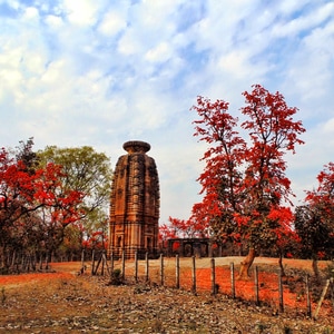
CHELIAMA -
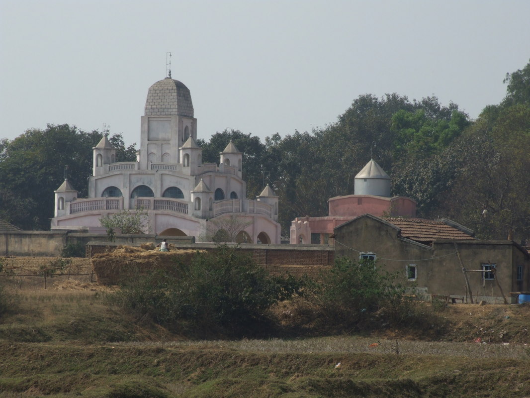
A big village on Ahalyabai Road in Raghunathpur II block and the head quarters of that block. The village contains the temple most richly decorated with terracottas in Purulia district and one of the few surviving from the 17th century in West Bengal. The temple of Radha-Vinod, dated sakabda 1619 has a contemporary terracotta plaque in Bengali. In the panels above the archways are depicted Krishnalila scenes. There is also scene like Rama comforting with Ravana in two huge war chariots with monkeys and demons joining in the fray. A series of smaller panels rising on the left and right and continuing across the top includes the avatars of Vishnu, the other deities as well as devotees. Along the base on the left ran the usual Krihnalila frieze, and on the right (much less common) a Ramayan frieze. Beneath them is another frieze of professional and hunting scene. The base and the column panels of the façade are already badly worn but the panels above the archways are in excellent condition.
A big village on Ahalyabai Road in Raghunathpur II block and the head quarters of that block. The village contains the temple most richly decorated with terracottas in Purulia district and one of the few surviving from the 17th century in West Bengal. The temple of Radha-Vinod, dated sakabda 1619 has a contemporary terracotta plaque in Bengali. In the panels above the archways are depicted Krishnalila scenes. There is also scene like Rama comforting with Ravana in two huge war chariots with monkeys and demons joining in the fray. A series of smaller panels rising on the left and right and continuing across the top includes the avatars of Vishnu, the other deities as well as devotees. Along the base on the left ran the usual Krihnalila frieze, and on the right (much less common) a Ramayan frieze. Beneath them is another frieze of professional and hunting scene. The base and the column panels of the façade are already badly worn but the panels above the archways are in excellent condition.
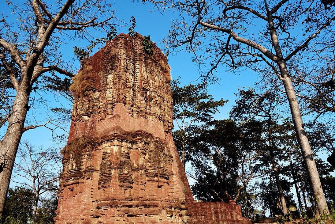
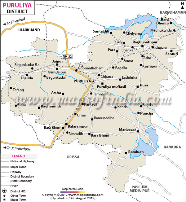
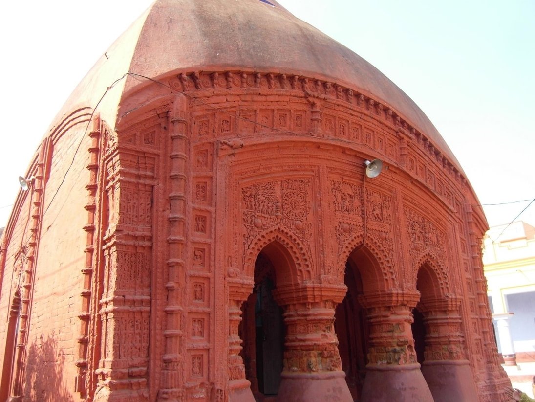
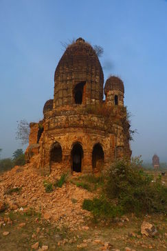
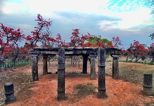
DEULGHATA-
A place near Boram in Arsha PS. It has ruins of some 15 temples and small shrines near the Kansai River about 6 kms from Joypur. Among them are 3 tall brick deuls with stucco decoration. The largest of which is to the south. All the trees have triangular corbelled entrances with towers built up by interior corbelling. The corbelled entrance of the southern temple is high and graceful with a delicate carve. All of them have rich curved brickwork with stucco application. They depict chaityas and miniature rekha motifs. The stucco application includes scrollwork with geese and foliation, dwarfs familiar from Pala-Sena art. The stucco is fine and would appear to date from the same period as that on the Bahulara and Satdeulia temples. The hunched supporting figures on the middle temple recall those on the 15th century temples of Barakar. But there is nothing else significant in common between these temples. Deulghat figure are much livelier and more rhythmical. All these temples have lost the tops of their towers, together with the amalakas and kalasas, m but the western and southern ones still stand to a height of 50 feet or more, the Western one specially, on a base about 16 feet square, seems to have been slender and graceful, the southern one, 24feet square, is about the same size as the Bahulara temple. As on of of the rekha temples in Purulia district, the panks are basically tri-ratha (single central projection). Complicated by many decorative recesses or subsidiary rathas.At least the central and Western temples seem to have originally had stone door-frames on a slightly projecting porch or antarala (entrance passage) to judge by the curved stumps still in situ. Each temple has a carved stone maker water outlet on the northern side.
The other temples at Deulghat which are mostly of stone have all fallen down. The largest stands at the head of a flight of steps leading up from the river – a low mount in Begler’s Day on which he found a slab inscribed in characters which may belong to the 9th or the 10th century. The establishment seems to have been Savite, for besides the lingas in situ, all then images relate to this cult. An image of Uma- Maheshvar has been removed to the State Archeological Galley. The oldest temples may be the bricked-temples, to judge by superiority of the workmanship, they had the large tile-like bricks typical of the Pala period.
PAKBIRRA -
Only three temples are standing, all of them has lost most of their frontal stones. The smallest of this faces east. The other two face north. This two temples, buried several feet upto the level of the wall niches, still have some of the lower façade stones, which give an idea of their appearance. The have the basic tri-ratha plan with simplified squad of moldings. The large amalaka fragments lying about, and the stone kalasas with lotus buds emerging, make us suppose that most of the temples here belonged to the usual nagara order. The principal temple, of which Beglar could only describe the foundations, was very large’ containing the full compliment of preliminary chambers and hall in front of the sanctum’. That temple, facing west, perhaps enshrined the colossal figure of a naked Tirthankar over two meters high, with lotus symbol on its pedestal, which still stands, along with a number of other Jaina sculptures, in an improvised stone-shed over the site of the original temple. Near-by Begler excavated five more Jaina sculptures ‘of late age’ from brick mounds.
The sculptures at PAKBIRRA are of Jaina affinity. The aforesaid shed has more than eight standing tirthankaras, including three with the bull symbol (rishabhanatha). Two with the lion (Mahavira) one with the horse (samhabhanatha), one with the lotus (padmaprabha), and one with the half-moon (chandraprava), two images of Yaksha and Sasanadevi beneath a tree with a Jina in the branches, three votive stupas (two with standing and one with seated Jinas each side), two being of the usual rekhashikhara variety, but the other possibly intended to represent a Bhadra (Deul), a curious small image of a four-armed deity, apparently holding a goad and noose, seated on a dog, Ambika with child and attendant, standing on her lion, beneath a flowering tea, and numerous fragments. There seems little doubt that these were the images originally enshrined in the temples, or placed in the exterior niches and some of the fragments may indicate the exterior decoration. A short distance to the south east is another shed of roughly assembled stone blocks, which contains five standing tirthankaras, one within the bull symbol, two with the bull between two lions (one of them over 1.2 mt high, one with the deer “Shantinatha”), and one of the Parsvanatha, broken of at the west with the entwined nag and nagini between two lions at base. Yet another image of Rishabhanatha stands on the ruinous mount of another large stone temple about forty six meters to the east, almost in the village. A small image of the Yaksha Kuvera has been removed to the museum of the archeological directorate of the Government of West Bengal.
SUISSA -
a number iconic images are seen here, probably obtained from the temples which once existed here or in the neighborhood. These are a 1. Large four armed Vishnu unsual tribhanga pose, along with Sri and Sarasvati, and devotees on the pedestal but no Garuda, 2. Ambika, broken into may pieces, 3. A Chaturmukha votive shrine of rekha-type, with seated tirthankara, 4. Several images of different sizes, of tirthankaras (including Parsvanatha) – some intact, some broken (with symbols like a pot, a lotus of a wheel, the sun, a lion etc.) 5. Another Ambika, 6. A linga, 7. Amalaka 2.5 ft across, 8. A decorated door-jamb, several curved stone fragments. These statues were worshipped under Hindu names when Begler saw them, but are now lying about neglected.
a number iconic images are seen here, probably obtained from the temples which once existed here or in the neighborhood. These are a 1. Large four armed Vishnu unsual tribhanga pose, along with Sri and Sarasvati, and devotees on the pedestal but no Garuda, 2. Ambika, broken into may pieces, 3. A Chaturmukha votive shrine of rekha-type, with seated tirthankara, 4. Several images of different sizes, of tirthankaras (including Parsvanatha) – some intact, some broken (with symbols like a pot, a lotus of a wheel, the sun, a lion etc.) 5. Another Ambika, 6. A linga, 7. Amalaka 2.5 ft across, 8. A decorated door-jamb, several curved stone fragments. These statues were worshipped under Hindu names when Begler saw them, but are now lying about neglected.
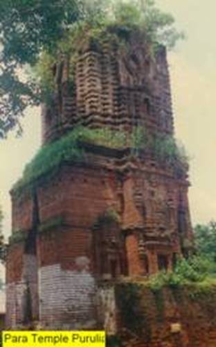
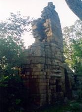
PARA-
A village with a station of the thana of the same name, it has two pre-Muslim deuls to the east. One belongs to the type of the three-brick temples of Deulghat.
Its top has fallen down along with most of the stucco, but some carved brick work still remains. The lower walls have three niches each-one on each of the projections (as at Deulghat), surmounted by tall rekha shikharas in relief, with pilasters on either side of them. The tower has a big heart-shaped chaitya in the centre on each of the four faces. It has a trefoil niche below, and the usual moldings up the pagas.
The entrance is the usual tall corbelled triangle. Thelower portion of the exterior walls, measuring about 5 meters square, has been given a protective brick casing, now partly fallen away. To the east there is a stone temple of about the same size, though not so tall as the brick temple originally was.
It has rich overall carving in soft sandstone, though weathered beyond recognition. Immediately to the south-west of the brick temple is a large mound, containing the carved stone fragments of another early temple, perhaps larger than the other two. Beglar mentions two pilasters with Plain Square mouldings.
At the opposite end of the village there is another temple of a later period. It is built of stone, with a plain square shrine, about 6 meters square, preceded by a slightly smaller sporch. The temple of Radharaman is now in complete ruins, on which no terracotta panels remain; nor are any to be seen on any other temple. Beglar was told that the Radharaman an temple was built by one Purushottam Das from Brindavan, during the viceroyalty of Man Singh, to whom the later stone temple was attributed. The tomb or Chhatri of Purushottam Das stands opposite the temple. Also in the village is a small mound with a ling, some pillars, and makara waterspouts.
BAGHMUNDI-
A place in the thana of the same name. It has within the rajbari compound, an at.chata temple of Radha Govinda, dated sakabda 1675 (A.D. 1733), which is badly overgrown with thicket and measures about 19 feet square. The facade is decorated with lotus medallions and other floral and geometrical designs in terracotta, but has no figures. The new Radha-Govinda temple is a flat-roofed modern stracture,also tending to crumble. There is a small, octagonal rasmancha nearby with nine pinnacles, having terracotta figures on four out of the eight sides. These consist of enthroned Rama and Sita with entourage, Krishna in rasmandala with the gopis, episodses lIke the holding up of Giri Gobardhan, or the killing of Bakasur, and many secular figures and animals-all crudely modelled. There is also a plain pancharatna Siva temple. All these were built by the Rajas of Baghmundi.
A place in the thana of the same name. It has within the rajbari compound, an at.chata temple of Radha Govinda, dated sakabda 1675 (A.D. 1733), which is badly overgrown with thicket and measures about 19 feet square. The facade is decorated with lotus medallions and other floral and geometrical designs in terracotta, but has no figures. The new Radha-Govinda temple is a flat-roofed modern stracture,also tending to crumble. There is a small, octagonal rasmancha nearby with nine pinnacles, having terracotta figures on four out of the eight sides. These consist of enthroned Rama and Sita with entourage, Krishna in rasmandala with the gopis, episodses lIke the holding up of Giri Gobardhan, or the killing of Bakasur, and many secular figures and animals-all crudely modelled. There is also a plain pancharatna Siva temple. All these were built by the Rajas of Baghmundi.
BIRINCHINATH-
Near Mandandi, in Neturia police station, on the southern lower slopes of the Panchet hill, it is the site of an old temple which has now disappeared. Asunken linga is approached by steps into a pit with a modern superstructure. Many stone fragments with architectural mouldings and incisions are lying about; some have been reused for making the steps up the hill. Fragments of amalaka and finial suggest the former existence of a rekha-deul here.There is a modern mandapa on old columns. a Nandi bull near another ancient linga and the pedestal of an old image. Apart from Birinchinath, modern painted clay-imagesof Radha-Krishna and Sarabhuja Jagaddhatri are worshipped in the modern structures.
Near Mandandi, in Neturia police station, on the southern lower slopes of the Panchet hill, it is the site of an old temple which has now disappeared. Asunken linga is approached by steps into a pit with a modern superstructure. Many stone fragments with architectural mouldings and incisions are lying about; some have been reused for making the steps up the hill. Fragments of amalaka and finial suggest the former existence of a rekha-deul here.There is a modern mandapa on old columns. a Nandi bull near another ancient linga and the pedestal of an old image. Apart from Birinchinath, modern painted clay-imagesof Radha-Krishna and Sarabhuja Jagaddhatri are worshipped in the modern structures.
BUDHPUR-
A village at Manbazar P.S., it is about 11 kms. south of Pakbirra and 6 kms. North of Manbazar on the Hura Road, on the north bank of the Kasai River. There was a large temple of Buddheswara Siva here. The temple had attached mandapas earlier, but now fallen down.
In Beglar's time, the main tower was replaced by brick-and-plaster work. In 1926 was in it was replaced by a rough stone tower having curved entrance.Four smaller shrines at the corners of the enclosure form a panchayatana arrangement. But now only one is partly standing, with simplified mouldings and squared pillastertypical of Telkupi. The position of the others being understood from their bases amidst the rubble. From the curved fragments of amalakas, chaityas, etc., it appears that all these temples were in the nagara style. The place is now full of tumbled down blocks of stone containing pillars, door-jambs and a makara water-spout. Apart from these five, Beglar also found no less than five other temples, all small, to the north-east of the enclosure. The original lingo too, seems to have disappeared, for a pillar has now taken its place and is worshipped in the main sanctum. Three sculptural remains found at the site were cult images; to judge by their heavy pedestals, one was a standing Vishnu, another a standing Ganesa and one was Ganesa seated in Ialitasana. Their style having Orissa similarities, like the sculptures at Deulghat, though less richly carved. Beglar dates them to the 12th or 13th centuries.
CHARRA-
A village, in Puruliya Muffasil thana, situated at north-east of Puruliya town. Until recently, there were two small stone built rekhadeuls in this village. The one which still stands has plain tri-ratha wall with only rudimentary mouldings at the base, but the tower is extensively carved with square bhumiamalakas, large chaityas on the central projection, and small chaityas on the sections. The ornamentation of the shikhara suggests an earlier stage than that of the Telkupi temples. Its amalaka is still in position. The other temple, which has fallen down, was entirely plain; it was pancharatha in plan, with no base mouldings. This temple faced south and the other one east. Both were empty, but it may be that they were originally Jaina temples as there are many loose Jaina sculptures strewn around the village. According to local tradition, some large tanks in the vicinity were sunk by Sarak-jains.
A village, in Puruliya Muffasil thana, situated at north-east of Puruliya town. Until recently, there were two small stone built rekhadeuls in this village. The one which still stands has plain tri-ratha wall with only rudimentary mouldings at the base, but the tower is extensively carved with square bhumiamalakas, large chaityas on the central projection, and small chaityas on the sections. The ornamentation of the shikhara suggests an earlier stage than that of the Telkupi temples. Its amalaka is still in position. The other temple, which has fallen down, was entirely plain; it was pancharatha in plan, with no base mouldings. This temple faced south and the other one east. Both were empty, but it may be that they were originally Jaina temples as there are many loose Jaina sculptures strewn around the village. According to local tradition, some large tanks in the vicinity were sunk by Sarak-jains.
GANPUR-
A village at Santuri P.S. It has on its outskirt an abandoned temple which exemplifies the type of atchala temple, especially built in the 17th century in Bankura district (e.g., at Simlapal, Sabrakon, Tejpal).
The upper tower hardly projects over the lower roof, and the lines of the roof flow into each other, giving the look of a charchala temple. The base measures 23 feet square, witha pillared porch at the front, and a single chamber-15 feet 6 inches by 7 feet 2 inches; the ceilings of the chamber is a pointed vault. The temple is made of Barakar sandstone, and originally had brick enclosure wall.A brick rasmancha was possibly there nearby. The brick temple is in good condition, but the image (that of Raghunath) is said to have been removed to Cholbalpur in Kulti P.S. of Barddhaman district.
TELKUPI-
A village at Raghunathpur P.S., and about 8 kms. north-east of Cheliama, it was earlier visited by Beglar who described this place as 'containing, perhaps, the finest and largest number of temples within a small space that is to be found in the Chutia Nagpur Circle in Bengal'. He listed over twenty temples and referred to several others and to 'numerous mounds, both of brick and stone, but more of brick !'
Bloch visited the place in 1902, when the number of the well-preserved temples had diminished considerably, as he found ten, more or less complete temples. Out those only two stand today and one more is visible half-submerged in the Damodar reservoir at the Panchet Dam.
The site was on the south bank of the Damodar –the crossing of the former trade route between Bihar and Orissa -subject to erosion from floods and has now been permanently
submerged after the construction of the Panchet Dam.
The one that is half under water towards the other side of the lake is the No. 10 of Beglar's list-a late structure, probably of the time of Man Singh, with an ugly shikhara divided up by horizontal ridges and two mandapas with pyramidal roofs in these sections.
Beglar's No. 10 is one of his first group of thirteen, all of which must have been submerged. The two temples that are standing now on the very edge of the river seem to belong to Beglar's second group, although one of them contains a linga, whereas Beglar's second group contains only Vaishnava temples. Both these temples are almost similar
in design to the Banda temples. Between these two temples are the mounds of two more, with carved fragments indicating that they were of the same style as the two others. One
has a lingam ; the other has a fragment of a doorframe with five carved bends, including a series of figures in the niches.
Durga Bera
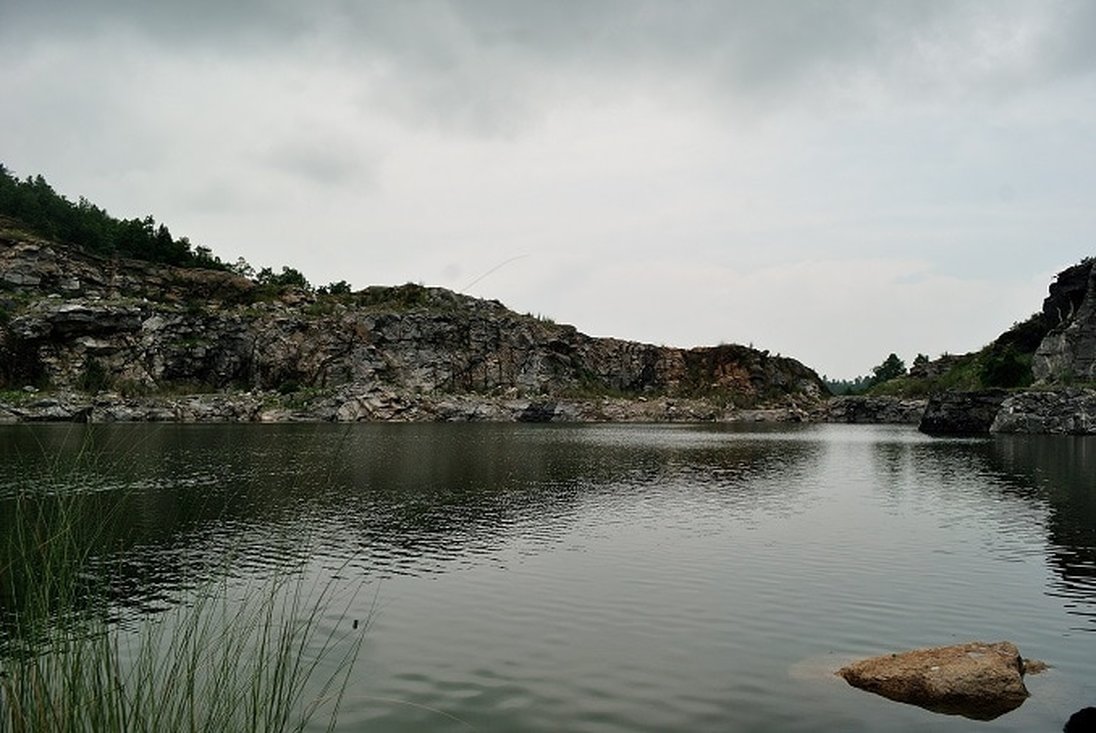
Durge Bera is 40 feet deep artificially made water body. It gives a amazing color under a clear sky. The water turns blues and looks fresh pure and transparent. Therefore this place is also known as “Nil Jal “too. This place has been created by extracting hard igneous rocks which has been used for construction of Hydro Project. So the extracted rocks are everywhere surrounding the water body.
Location: Durga Bera lies near Ranga village of Ajodhya Gram Panchyat at Baghmundi Block in district Purulia in West Bengal in eastern India. It is located at an altitude of 2000 ft above the sea level. Its 58 Km from Purulia via Sirkabad
Attraction:
1.Durga Bera is a Blue Watered body under a clear sky so it’s also called “Nil Jal”
2. It is the home to plenty of fishes. So the tourists can also try out fishing /angling in its water.
3.Durga Bera contains the rich flora and fauna. The lake is dotted with different colorful flowers in Garden surrounding the water body. This lake structured water body is surrounded by the majestic mountains and with the groves of chinar, poplar and willow. Durga Bera is also the birds’ paradise.
4.Tourists on the tour to Durga Bera can explore and boating in the blue water.

Deulghata
Deulghat, a place near Boram in Arsha PS. It has the ruins of 15 temples near the Kansai River. The stucco decoration is the notable architecture made on the temple. The entrances of those temples are entangled with the branches of trees, casting an eerie. However these temples are the representations of the age, when they were built. The excellent skills are evident in the wreckage of the temples and idols reflect strong evidences of SEN & PAL empires. Moreover the temples adorned with the graceful carve, attracts visitors, and hence are important in the tourism of Purulia.
Deulghat, a place near Boram in Arsha PS. It has the ruins of 15 temples near the Kansai River. The stucco decoration is the notable architecture made on the temple. The entrances of those temples are entangled with the branches of trees, casting an eerie. However these temples are the representations of the age, when they were built. The excellent skills are evident in the wreckage of the temples and idols reflect strong evidences of SEN & PAL empires. Moreover the temples adorned with the graceful carve, attracts visitors, and hence are important in the tourism of Purulia.

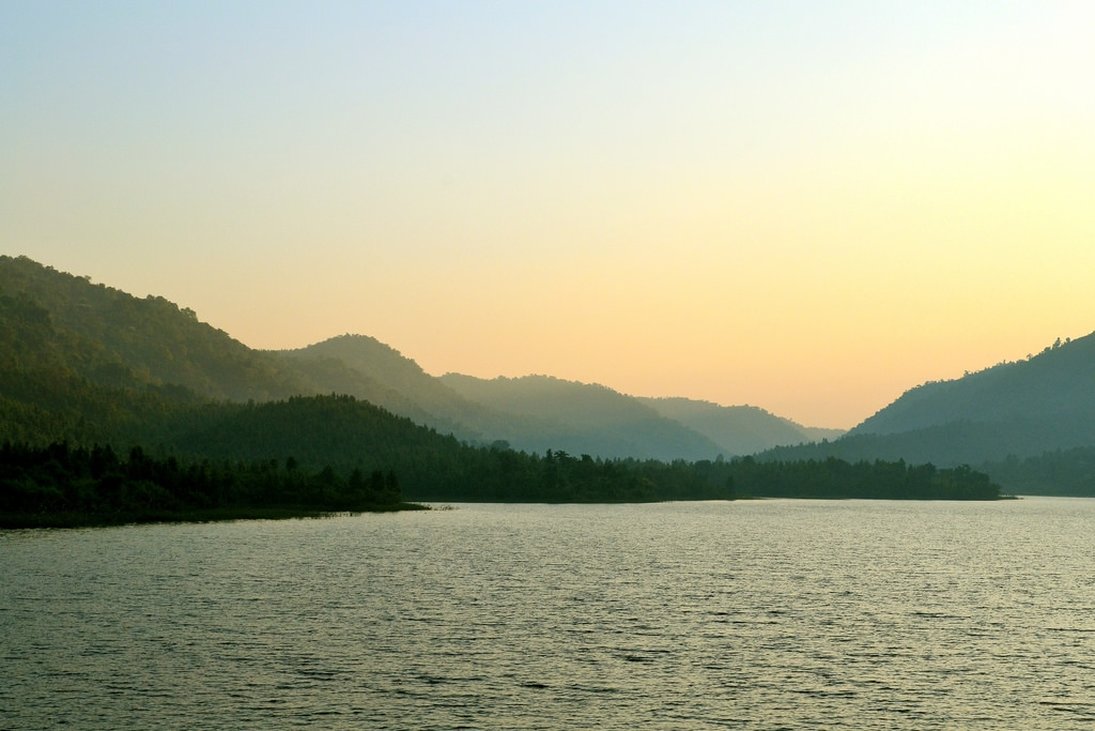
Murguma
It is located in the north of Begunkodar within Jhalda Block and is about 55 kms from Purulia town. The dam is on the tributary of Kangsabati river. This is a very good picnic spot. The natural beauty of Ajodhya hill is visible from this point.
It is located in the north of Begunkodar within Jhalda Block and is about 55 kms from Purulia town. The dam is on the tributary of Kangsabati river. This is a very good picnic spot. The natural beauty of Ajodhya hill is visible from this point.
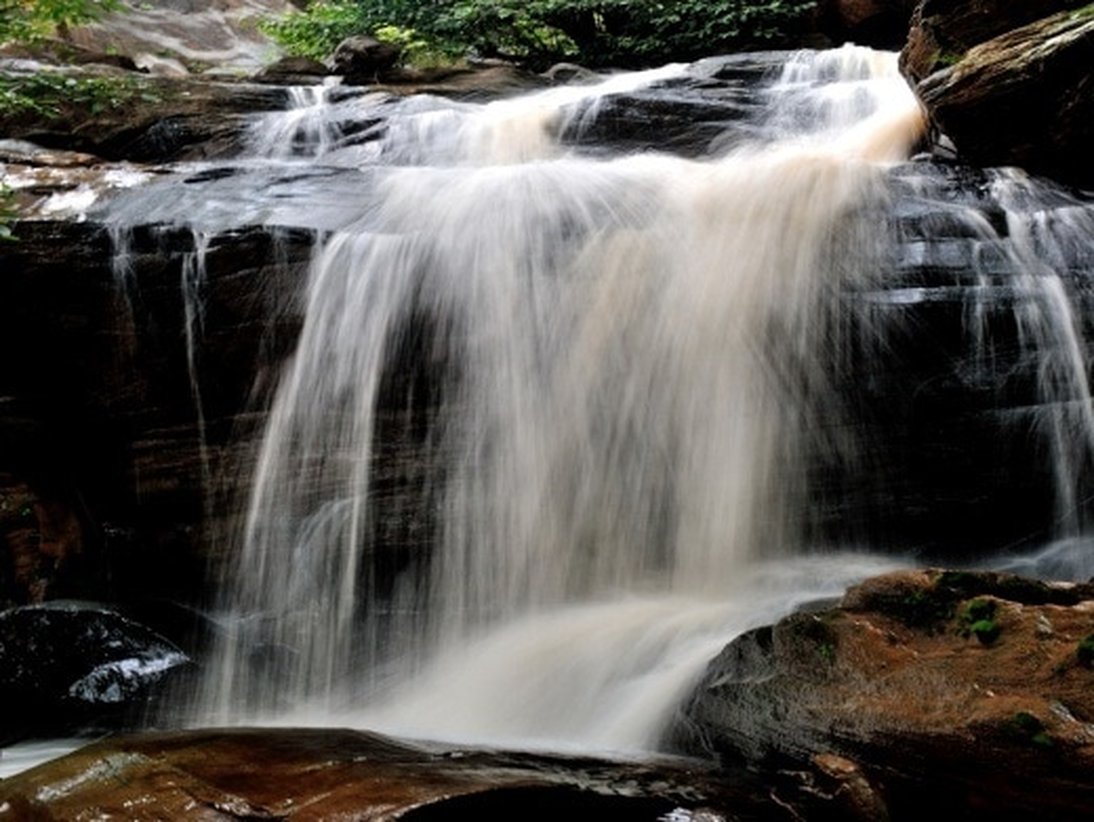
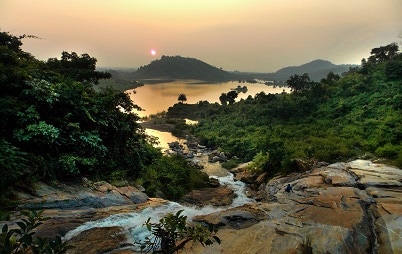
Bamni Falls
The scene indicates the unblemished purity of nature when not ravaged by human habitation. It represents the vitality, spirit and enjoyment of nature. The air is damp and moist. The smell is of spruce trees which surround the waterfall and stream and of the soggy, wet air. The sound of flowing water is all that can be heard. The water, making its way around, over and through the rocks, makes a beautiful noise. Green bushes cover the hill where large rocks are not exposing themselves. Below the bushes are signs of erosion where the flowing water has carried the dirt down the hill. The erosion is barely noticeable; the many beautiful aspects of the scene conceal this minuscule flaw of perfection. Moss, drenched in water, covers the rocks and huge logs which lay on the bank of the stream. The moss is light yellow in some areas and dark green in others. Small plants and algae are on the rocks as well. The whole area brings an uplifting feeling. It is an area to connect with one’s inner soul and to raise one’s spirits. A place to sit, daydream and simply enjoy the uniqueness of the peaceful, serene nature which is becoming rare.
Location: It’s on the way to Baghmundi from Ajodhya. It comes under Ajodhya Gram Panchyat in Baghmundi Block .It is 52 Km from Purulia district town via Sirkabad.
Attraction: After adventures exertion to reach the panorama one would enjoy the astounding stepping down of water and the spell of rain like droplets on an individual Full view of the creek and the beauty of the scene from the watch tower give an enchanting experience to an individual. Away from strident city life the charming songs of colorful birds and chattering noise of squirrels make the environment a pleasant place to be in.
Turga Falls
It’s a cascading water fall. Its water is the very clear. One can see through it as if it were a piece of glass. The water slid down smoothly as it fell, having no problems with the giant drop. The sleek sapphire descent was simply staggering to observe. Each drop of water fell with its own clarity, making a vast splash upon the level surface below. This Turga waterfall seems downpour from clear sky. The giant spray from below was reaching up towards the sky in order to touch it. It’s really magnificent watching. The onslaught of water was like a cascade of never-ending rain. The drop downward was drenching, dripping, and dousing to those daring enough to look at it. Though, it can seem a bit overwhelming, the view is one of the most breathtaking ever seen. Every rock protruding out made the water grasp for something in the distance as it fell out of the sky. The splashes emerging out of the water was steam coming off the ground on a cold day. The clouds covered the clean cobalt color soaking the sky. The clouds were small puffs of cotton floating in the sky. They floated in the sky, making the picture that much better than it was before. The air was vacant of birds as the noise ear-shattering. Every glimpse of the sky was like a pathway to another land in the way that it shone through. It glowed with an amazingly bright light that couldn’t be compared to anything else. The horizon was a never-ending line that followed the water in unison. The sky and the water met along the edge of nothingness. The simplest thing in the picture has become like the most superb stroke on a painting.
Location: It’s on the way to Baghmundi from Ajodhya. It comes under Ajodhya Gram Panchyat in Baghmundi Block .It is 57 Km from Purulia district town via Sirkabad.
Attraction:
1. Flowing water from the hill in all directions. In some areas it falls in thick sheets from ridges high above. The water is clean, clear, pure and unpolluted. It flows swiftly over weathered rocks and thick moss. Below a bed of rocks lies a small pool. Water bugs walk on the surface of the pool, aimlessly wandering - as if vagabonds - in all directions.
2. Away from strident city life the charming songs of colorful birds and chattering noise of squirrels make the environment a pleasant place to be in.
Sita Kund
Sita Kunda is located in Bagandi village under Ajodhya Gram Panchyat at Baghmundi Block of Purulia district of West Bengal. It’s a beautiful place surrounded by small water bodies with lotus floating on them. The mesmeric medium dense natural forest with peaceful surrounding makes it a perfect tourist destination that gives a rustic ambience and for whole hearted prayer.
Location: At Bagandi village of Ajodhya Gram Panchyat in Baghmundi Block .It is 47 Km from Purulia district town via Sirkabad.
Attraction:
The cold water bubbles from beneath invading the white fine sand at Sita Kund are mystical and astonishing pristine fresh water springs and streams. Other than this traveler can see different kind’s colorful birds which come especially in winter. The most interesting thing is visibility of existing hairs of Sita as the locals say, on different Sal trees. A 20 year old Ram Mandir is also very famous at this place.
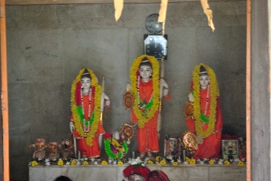
Mythology:
Sita Kund is a place which is associated with the classic Ramayana. According to Hindu mythology, Rama and Sita had come to Ayodhya Hills and stayed during their exile. Sita was thirsty and Ram pierced an arrow through the Earth's soil crust and through that pristine fresh water springs and streams gushed out. Sita quenched her thirst. The place is known as Sita-kunda.
People belong to Tundra community drink water from Sita kundu before going for Shikar (Hunting) because they think Sita kund is a holy place for them. The local people have constructed a beautiful Ram Mandir or temple just 500 meters away from the Sita Kund. The common people offer prayer to both the places consecutively.
Fairs and Festivals: Local tribal people of the Ajodhya hill join in the hunting of wild animal in the full moon (Purnima) day of Baisakha in this place.
Sita Kunda is located in Bagandi village under Ajodhya Gram Panchyat at Baghmundi Block of Purulia district of West Bengal. It’s a beautiful place surrounded by small water bodies with lotus floating on them. The mesmeric medium dense natural forest with peaceful surrounding makes it a perfect tourist destination that gives a rustic ambience and for whole hearted prayer.
Location: At Bagandi village of Ajodhya Gram Panchyat in Baghmundi Block .It is 47 Km from Purulia district town via Sirkabad.
Attraction:
The cold water bubbles from beneath invading the white fine sand at Sita Kund are mystical and astonishing pristine fresh water springs and streams. Other than this traveler can see different kind’s colorful birds which come especially in winter. The most interesting thing is visibility of existing hairs of Sita as the locals say, on different Sal trees. A 20 year old Ram Mandir is also very famous at this place.
Mythology:
Sita Kund is a place which is associated with the classic Ramayana. According to Hindu mythology, Rama and Sita had come to Ayodhya Hills and stayed during their exile. Sita was thirsty and Ram pierced an arrow through the Earth's soil crust and through that pristine fresh water springs and streams gushed out. Sita quenched her thirst. The place is known as Sita-kunda.
People belong to Tundra community drink water from Sita kundu before going for Shikar (Hunting) because they think Sita kund is a holy place for them. The local people have constructed a beautiful Ram Mandir or temple just 500 meters away from the Sita Kund. The common people offer prayer to both the places consecutively.
Fairs and Festivals: Local tribal people of the Ajodhya hill join in the hunting of wild animal in the full moon (Purnima) day of Baisakha in this place.
KHAIRABERA
This is an Irrigation Dam amidst hills and forest at Baghmundi. It is a beautiful and pleasant place with high potentiality to be developed as an attractive tourist spot. It is situated at the Baghmundi block some 70 Km away from Purulia town, this place has a vast water body at the foot hills of Chemto and Barra Hills (Ajodhya –range).During the spring ( Holi season ) the Palash trees add a new spectrum to the scenic beauty of the area with their red-flowers. The place has ample scenic beauty and resources to be developed as a prime tourist spot.
This is an Irrigation Dam amidst hills and forest at Baghmundi. It is a beautiful and pleasant place with high potentiality to be developed as an attractive tourist spot. It is situated at the Baghmundi block some 70 Km away from Purulia town, this place has a vast water body at the foot hills of Chemto and Barra Hills (Ajodhya –range).During the spring ( Holi season ) the Palash trees add a new spectrum to the scenic beauty of the area with their red-flowers. The place has ample scenic beauty and resources to be developed as a prime tourist spot.
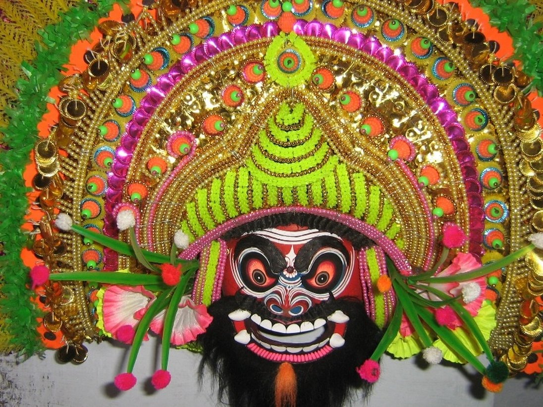
CHARIDAH
Masks of Charida village in Baghmundi block of Purulia (WB) used in the martial dance “Chhau” which is internationally famous. Around 250 artisans of Charida village are involved in this craft. RAM KRISHNA HASTA SHILPA SAMITY - a SHG of 13 members from Charida village are professionally engaged in this mask manufacturing and they have been awarded at the national level for their effort too.
Masks of Charida village in Baghmundi block of Purulia (WB) used in the martial dance “Chhau” which is internationally famous. Around 250 artisans of Charida village are involved in this craft. RAM KRISHNA HASTA SHILPA SAMITY - a SHG of 13 members from Charida village are professionally engaged in this mask manufacturing and they have been awarded at the national level for their effort too.
GARH PANCHAKOT
It’s a famous historical place located within Neturia Block, and is 60 kms away from Purulia town. It has the ruins of some forts built by the kings of Panchakot in 1600 A.D. Garhpanchakote is located in the eastern part of India at the foot hills of Panchakote in the district of Purulia, West Bengal, the ruins of the Panchakote Palace are a silent testimony to the Bargi attack during the 18th century This isolated, quiet and serene valley resonates with the melodious chirping and symphony of different variety of birds. Alongside nature’s amazing beauty, Garhpanchakote is also a testimonial to a rich ancient historical heritage. The Panchakote Hill is also enriched with Zoological Treasure.
It’s a famous historical place located within Neturia Block, and is 60 kms away from Purulia town. It has the ruins of some forts built by the kings of Panchakot in 1600 A.D. Garhpanchakote is located in the eastern part of India at the foot hills of Panchakote in the district of Purulia, West Bengal, the ruins of the Panchakote Palace are a silent testimony to the Bargi attack during the 18th century This isolated, quiet and serene valley resonates with the melodious chirping and symphony of different variety of birds. Alongside nature’s amazing beauty, Garhpanchakote is also a testimonial to a rich ancient historical heritage. The Panchakote Hill is also enriched with Zoological Treasure.
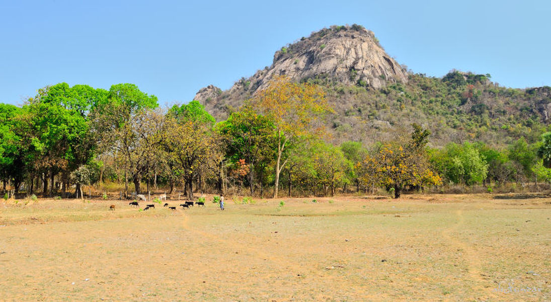
Jaichandi Pahar
Jaichandipahar is located very close to the Municipal town Raghunathpur. It is about 44 kms from Purulia. This is a very popular trekking spot. It is also an important picnic spot. Railway Station Jaichandipahar is in the vicinity of the spot. All facilities are available at nearby Raghunathpur town.
Jaichandipahar is located very close to the Municipal town Raghunathpur. It is about 44 kms from Purulia. This is a very popular trekking spot. It is also an important picnic spot. Railway Station Jaichandipahar is in the vicinity of the spot. All facilities are available at nearby Raghunathpur town.
Panchyet Hill & Dam
Panchyet Hill is situated at the North – East corner of Purulia District near the border line between West Bengal and Jharkand close to North-West end of Burdwan District of West Bengal and South-West to Panchyet Dam on Damodar River and its tributary. The height of the Hill is 2017 ft. above Sea level and it is the 2nd highest Hill in Purulia after Ajodhya. Panchyet Hill along with its rich forest was within the Panchakot Raj Estate under the control of erstwhile Maharaja of Kashipur and is historically important and was actually used as a Fort of the Maharaj, being a safe place to counter enemies and that is why this Hill is also known as Gar-Panchyet Hill. It has vegetal cover having flora of wide Bio-diversity and contiguous huge reservoir of Panchyet Dam. The Hill top is accessible by forest road maintained by the Department of forests. It offers a picturesque and panoramic view of the forest and the Dam. For promotion of tourism West Bengal Forest Development Corporation Limited have recently constructed Dormitory and suites at Eco.-Tourism Centre at Baghmara in Panchyet Hill whose booking can be done from their office at Raja Subodh Mallick Square, Kolkata. The Hill is not far from Purulia town and is very close to Adra Junction and Barakar Rail Station.
Panchyet Hill is situated at the North – East corner of Purulia District near the border line between West Bengal and Jharkand close to North-West end of Burdwan District of West Bengal and South-West to Panchyet Dam on Damodar River and its tributary. The height of the Hill is 2017 ft. above Sea level and it is the 2nd highest Hill in Purulia after Ajodhya. Panchyet Hill along with its rich forest was within the Panchakot Raj Estate under the control of erstwhile Maharaja of Kashipur and is historically important and was actually used as a Fort of the Maharaj, being a safe place to counter enemies and that is why this Hill is also known as Gar-Panchyet Hill. It has vegetal cover having flora of wide Bio-diversity and contiguous huge reservoir of Panchyet Dam. The Hill top is accessible by forest road maintained by the Department of forests. It offers a picturesque and panoramic view of the forest and the Dam. For promotion of tourism West Bengal Forest Development Corporation Limited have recently constructed Dormitory and suites at Eco.-Tourism Centre at Baghmara in Panchyet Hill whose booking can be done from their office at Raja Subodh Mallick Square, Kolkata. The Hill is not far from Purulia town and is very close to Adra Junction and Barakar Rail Station.
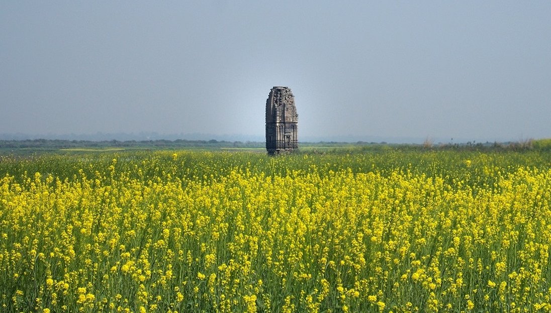
TELKUPI
A village at Raghunathpur P.S., and about 8 kms. north-east of Cheliama, it was earlier visited by Beglar who described this place as 'containing, perhaps, the finest and largest number of temples within a small space that is to be found in the Chutia Nagpur Circle in Bengal'. He listed over twenty temples and referred to several others and to 'numerous mounds, both of brick and stone , but more of brick .Bloch visited the place in 1902, when the number of the well-preserved temples had diminished considerably, as he found ten, more or less complete temples. Out those only two stand today and one more is visible half-submerged in the Damodar reservoir at the Panchet Dam. The site was on the south bank of the Damodar –the crossing of the former trade route between Bihar and Orissa -subject to erosion from floods and has now been permanently submerged after the construction of the Panchet Dam. The one that is half under water towards the other side of the lake is the No. 10 of Beglar's list-a late structure, probably of the time of Man Singh, with an ugly shikhara divided up by horizontal ridges and two mandapas with pyramidal roofs in these sections. Beglar's No. 10 is one of his first groups of thirteen, all of which must have been submerged. The two temples that are standing now on the very edge of the river seem to belong to Beglar's second group, although one of them contains a linga, whereas Beglar's second group contains only Vaishnava temples. Both these temples are almost similar in design to the Banda temples. Between these two temples are the mounds of two more, with carved fragments indicating that they were of the same style as the two others. One has a lingam; the other has a fragment of a doorframe with five carved bends.
A village at Raghunathpur P.S., and about 8 kms. north-east of Cheliama, it was earlier visited by Beglar who described this place as 'containing, perhaps, the finest and largest number of temples within a small space that is to be found in the Chutia Nagpur Circle in Bengal'. He listed over twenty temples and referred to several others and to 'numerous mounds, both of brick and stone , but more of brick .Bloch visited the place in 1902, when the number of the well-preserved temples had diminished considerably, as he found ten, more or less complete temples. Out those only two stand today and one more is visible half-submerged in the Damodar reservoir at the Panchet Dam. The site was on the south bank of the Damodar –the crossing of the former trade route between Bihar and Orissa -subject to erosion from floods and has now been permanently submerged after the construction of the Panchet Dam. The one that is half under water towards the other side of the lake is the No. 10 of Beglar's list-a late structure, probably of the time of Man Singh, with an ugly shikhara divided up by horizontal ridges and two mandapas with pyramidal roofs in these sections. Beglar's No. 10 is one of his first groups of thirteen, all of which must have been submerged. The two temples that are standing now on the very edge of the river seem to belong to Beglar's second group, although one of them contains a linga, whereas Beglar's second group contains only Vaishnava temples. Both these temples are almost similar in design to the Banda temples. Between these two temples are the mounds of two more, with carved fragments indicating that they were of the same style as the two others. One has a lingam; the other has a fragment of a doorframe with five carved bends.

MURADI DAM & BORONTI
Muradih Dam
About 15 Km. from Panchyet Hill , a big water body surrounded by hillocks. A famous picnic spot during winter season tourist parties come to the spot for picnic and enjoying scenic beauty. Many migratory birds come to this lake during winter. It is situated at the foothill of Muradih Hill. The water of this dam is mainly used for irrigation and fish production. The purified dam water is distributed in the neighboring villages through pipe line. The beauty of the dam is very attractive.
Boronti
A lake, surrounded by hills covered with thick vegetation. Its close enough to stop by for the weekend. The best way to visit Boronti is to take a night train to Adra. From there, a local train will take you towards Asansol, through the rugged landscape of Purulia, past the towering cliffs of Jaichandi, to the sleepy station of Muradi. From Muradi, you can take a jeep or a leisurely but bumpy rickshaw ride to Boronti.
RAKAB FOREST
Keshargarh is famous for Rakab Forest which was known to be the Forest of 16 cross and which was the Hunting place of Kashipur. Maharaja Keshgarh is famous for his fight against British Rulers and looted the Purulia Treasury. Fort is still lying in a dilapidated condition with other remnants of period attracts tourists. A mela is held named as Milmoni Mela. He was hanged to death by the British rulers. The place is nearly 35Km. from Purulia Town.
Keshargarh is famous for Rakab Forest which was known to be the Forest of 16 cross and which was the Hunting place of Kashipur. Maharaja Keshgarh is famous for his fight against British Rulers and looted the Purulia Treasury. Fort is still lying in a dilapidated condition with other remnants of period attracts tourists. A mela is held named as Milmoni Mela. He was hanged to death by the British rulers. The place is nearly 35Km. from Purulia Town.
Forest Division: PURULIA DIVISION
ECO-TOURISM
Places of Attraction –
Matha - Matha Buru (Matha hills) is commonly known for its esthetic beauty. Annual 'Mela' is originated on the hill by tribal community. Many nature camp and Rock Climbing courses are conducted by different organization mostly during winter season. Last year number of such camps was 31 and more than 2000 school &college students participated. Local Forest Protection Committee members are engaged for providing catering facilities for camp and some of them also act as local guides.
Pakhi Pahar - Is another tourist attraction with vicinity along with scenic beauty of Pardi Dam.
Eco-Shop - An unique attempt to provide facility to the local villagers to sale their handicraft produce to the tourist.
Gachbari (Tree house) - First time in South Bengal to provide tourist a feeling of staying above a tree. Under construction at Matha Range shortly to be completed.
Dowry Khal - Originating place of Sobha River, a tributary of Subarnarekha. Known for its natural beauty and a favourite camping place for adventure tourist.
Purulia Pump Storage Project - 900 M.W. capacity hydro-electric project. Upper dam surrounded by lash green Sal forest is a potential place for tourist destination.
Tugga and Bramni Falls - To perennial streams near Bagmundi favourite for day visitors and picnic party in winter.
Nature Interepretation Centre at Ajodhya - Under construction. Aimed to represent Ajodhya Eco-system along with tribal culture and tradition to the visiting tourists. Shortly to be completed.
Sirkabad - Base camp for rock climbers and trekkers who come to help rock climb courses at Gaja Buru, the top peak of Ajdohya Hill.
Dams surrounding Ajodhya Hill - Murguma, Pardi, Burda, Ramudih, Gopalpur are few dam sites which are liked by picnic minded people and tourists. They not only represent the scenic beauty but also serves as spot for bird watching.
